|
Remarks |
Cardinals: N↑ E→ S↓ W← Site: Valinda, CA (34.030N, 117.930W)
Alt 45° ───────────────────────────────────────────────────────────────
✷ Arcturus (α Boo / HIP 69673)
(Alt 28.33°, Az 274.95° ≈ W)
Alt 30° ───────────────────────────────────────────────────────────────
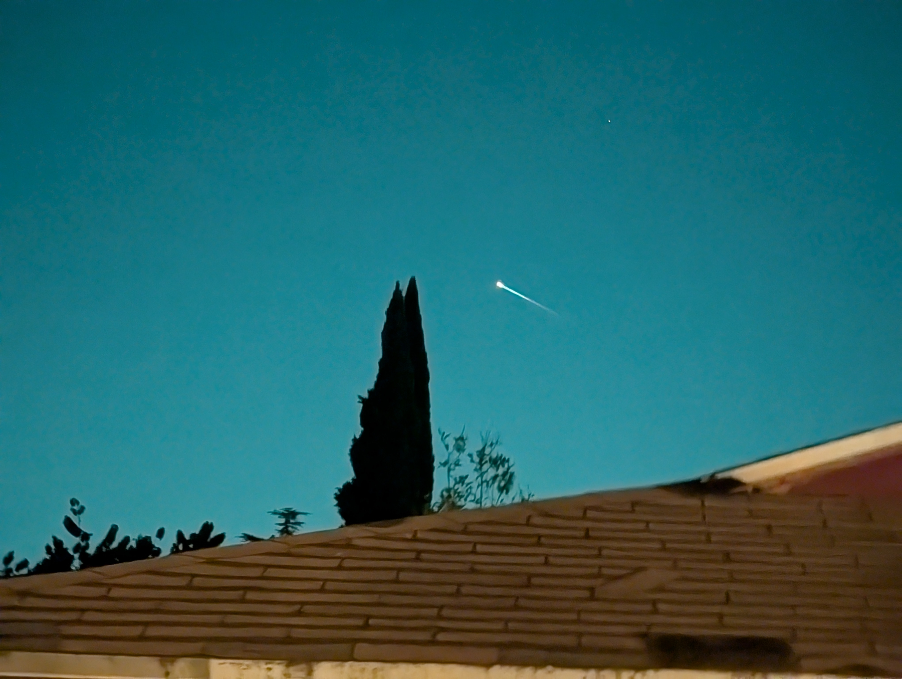
\ 🔥 Head (t0)
\ (~Alt 19°, Az ~295°)
\ ⚡ Vector ——▶ (t0→t0+2s)
\
Alt 15° ──────────────────────\─────────────────────────────────────────
\
\ ✷ Shaula (λ Sco / HIP 87569)
\ (Alt 16.76°, Az 195.50° ≈ SSW)
Horizon (Alt 0°) ──────────────── W(270°) ┃ 285° │ 295° │ 305° ┃ NW ───────────
Uncertainty wedge (±10°): 285°–305° Centerline: 295° Elevation band: ~15–25°
---
Here’s the plain-text pre-fill AMS info, formatted the AMS Fireball Report fields, to fill line by line:
Observer Information
Name: Angel I. Maciel
City: Valinda
State: California
Country: USA
Latitude: 34.030° N
Longitude: −117.930° W
Event Date and Time
Date (Local): September 2, 2025
Time (Local): ~8:50 PM PDT
Date (UTC): September 3, 2025
Time (UTC): ~03:50 UTC
Trajectory (Alt-Az Estimates)
Start (Meteor Head):
Azimuth: ~295° (WNW)
Altitude: ~20°
End (Trail Point):
Azimuth: ~295° (WNW)
Altitude: ~15°
(Note: replace with refined Alt-Az pairs once pixel offsets from Arcturus are measured and converted to degrees.)
Duration
Duration: ~2–3 seconds
Brightness
Apparent magnitude: between −5 and −8 (brighter than Venus, fainter than the Moon)
Appearance
Color: White-yellow glow
Trail: Short, incandescent streak, downward slant WNW
Fragmentation: None obvious
Sound: None heard
Reference Anchors
Arcturus (α Boo / HIP 69673) – Alt 28.3°, Az 274.9°
Shaula (λ Sco / HIP 87569) – Alt 16.8°, Az 195.5°
Photos / Evidence
Original images showing meteor streak with Arcturus and Shaula visible
AR star overlay screenshots
NotebookLM event log export (Cucumber Markdown + ASCII trajectory maps)
Additional Notes
Classified as Referenceable Random Occurrence (RRO, 7/7 conditions met)
Ground projection ladder: 30 km (San Fernando foothills), 60 km (Conejo Pass/Thousand Oaks), 120 km (Ventura–Oxnard), |